 |
      |
| Home > Arkansas > Moccasin Gap |
Moccasin Gap Trails
Tuesday, August 19, 2025
| Other Names | Black Oak Ridge, Gap Hollow, Mitchell Point, High Mountain Loop, Ozark National Forest, Stave Mill Falls, Moccasin Gap Campground, Big Piney Ranger District, Treat Road Staging Area |
| Last Known Status | Open |
Located right across the street from Mack's Pines, this multiple-use trail system offers around 30+ miles of moderately challenging trails, scenic vistas, seasonal stream crossings and a few waterfalls. Trails are marked, color coded and form long loops.
The trail system was originally designed for horseback riders but motorized use is permitted. The trails are open year-round but visitors are advised to wear blaze orange vests during hunting season (usually around mid November and in April).
Camping can be found at Moccasin Gap Campground. Amenities include water pumps (during summer and fall months), a solar powered shower, fire rings and trash cans. Additional parking can be found off Treat Road, which has enough room to accomodate ten vehicles.
REGULATIONS
| Permit Required | No | |
| Dates Open | Year-Round | |
| Other ATV Stickers Accepted | Unknown | |
| Spark Arrestor | Yes | A spark arresting exhaust silencer or end cap is required for all vehicles. |
| Noise Limit | Yes (96 dB) | |
| Whip Flags | Not Required | |
| Maximum Vehicle Width | Yes (50 inches) | has entrance gate or posts |
 Motorcycles & Dirt Bikes Motorcycles & Dirt Bikes | Permitted | |
 ATVs ATVs | Permitted | (maximum width 50 inches) |
 UTV & SXS UTV & SXS | Permitted | (maximum width 50 inches) |
 SUVs & Jeeps (registered) SUVs & Jeeps (registered) | Prohibited | |
| Dune Buggy & Sand Rail 4x4 (unregistered) | Prohibited | |
| 2 Stroke Engines | No Restriction | |
| MX Helmet Required | No | (RiderPlanet strongly recommends helmets for all riders.) |
 Camping Camping | Some Areas | (camp in developed sites only) |
 Campfires Campfires | Some Areas | (permitted in developed campsites only) |
| Night Riding | Unknown | |
| Trail Blazing | Prohibited | stay on trail |
| Rule Enforcement | ||
| Comment | Arkansas residents are required to register all 3 and 4-wheeled OHVs with the AR Department of Revenue. Decal is not a forest pass, it fulfills state requirements only. Arkansas residents can call their county revenue department for more information. | |
TERRAIN
| Approx Size | 1,000 acres (2 sq mi) | |
| Miles Of Trail | 30 | |
| Climate Type | Forest | |
| Elevation | 1300 to 1500 ft. | |
| Trail Maintenance | Marked, Not Rated, Lightly Maintained | |
| Loose Dirt |  Some Some | |
| Hard Pack |  Mostly Mostly | |
| Sand |  None None | |
| Mud |  Little Little | |
| Dust | Little | |
| Rocks | Some | |
| Trees |  All All | |
| Steep Hills |  Few Few | |
| Water Crossings | Few | |
| Small Jumps | None | |
| Large Jumps | None | |
| Berms | Few | |
| Sand/Gravel Pits | None | |
| Single Track | Some | |
| Roads | None | |
| Intersections | Some | |
| Rider Traffic | Some | |
| Shade | Some | |
| Hazards | Few | (hazards assumed marked but use caution) |
 Novice Novice | Mostly | |
 Amateur Amateur | Some | |
 Expert Expert | Little |
TYPE OF AREA
| Area | Motorized Trails |
| Land | National Forest |
GPS POINTS


KEY SERVICES
 Gasoline Gasoline | 1-5 Miles (S) | Moore's Sinclair (479) 331-2440 |
| Diesel | 1-5 Miles (S) | Moore's Sinclair (479) 331-2440 |
 Water Water | On Site | |
 RV Hookup RV Hookup | 1-5 Miles (S) | Mack's Pines (479) 331-3261 |
 RV Disposal RV Disposal | 1-5 Miles (S) | Mack's Pines (479) 331-3261 |
| Campground | On Site | |
 Conv Store Conv Store | 1-5 Miles (S) | Mack's Pines (479) 331-3261 |
FEES & PASSES
| Parking | (None) |
| Entry | (None) |
| Riding | Yes ($3.00 per OHV) Forest Service Permit |
| Camping | Yes Tent: $15.00 RV: $15.00 Addtl. Vehicle: $0.00 |
RATINGS
| Our Rating |  Good Good |
| Recommended Stay | Full Day |
| Comments | (Scroll Down For Rider Reviews & Comments) |
DRIVING DIRECTIONS
| Nearest City | Dover, AR | ||
| From: Russellville, AR
1) Take SR-7 North about 25 miles 2) Trailhead is on the left (west). |


OFFICIAL CONTACTS
| Contact Info | Ozark - Saint Francis National Forests 605 West Main Russellville, AR 72801 (479) 964-7200 mailroom_r8_ozark@fs.fed.us www.fs.usda.gov |
| Contact Info | Mack's Pines 22816 SR 7 North Dover Dover, AR 72837 (479) 331-3261 mackspines@yahoo.com www.macks-pines.com |
| Contact Info | Ashtyn's RV Resort And Cabin Rental (318) 453-7440 simpsonstefanie@yahoo.com |
| Comment | Nearby RV and cabin campground close to the trail system. |
Moccasin Gap Trail Photo
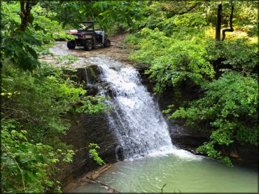
Photo Submitted 6/7/2015 (Thanks!)
Moccasin Gap Trail Photo
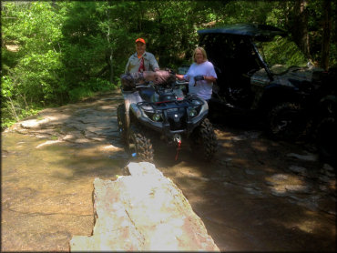
Photo Submitted 1/29/2017 (Thanks!)
Moccasin Gap Trail Photo
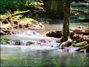
Photo Submitted 6/7/2015 (Thanks!)
Moccasin Gap Trail Photo
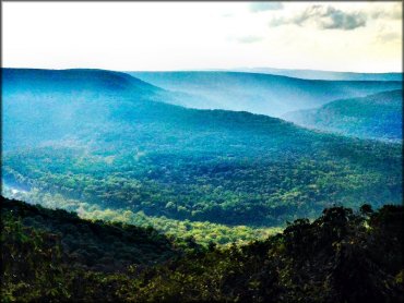
Photo Submitted 10/26/2014 (Thanks!)
Moccasin Gap Trail Photo
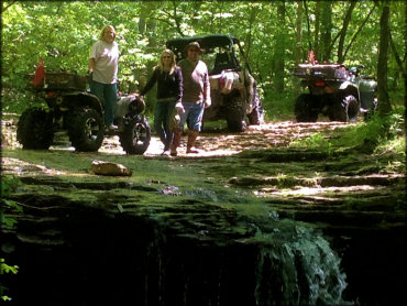
Photo Submitted 1/29/2017 (Thanks!)
RIDER COMMENTS & REVIEWS