 |
      |
| Home > Nevada > Peavine Canyon |
Peavine Canyon
Thursday, April 30, 2026
| Other Names | Peavine Creek Dunes, Peavine Creek, Horse Canyon, Big Smokey Valley, Arc Dome Wilderness, Humboldt Toiyabe National Forest, Tom's Canyon, Peavine Creek Campground |
| Last Known Status | Open |
Peavine Canyon (not to be confused with Peavine Mountain north of Reno) is located northeast of Tonopah near the Arc Dome Wilderness in the Toiyabe Mountain Range.
The campground, surrounded by aspen, cottonwood and willow trees, is popular with horseback riders and hunters. Peavine Creek, which flows through the campground, is small and shallow, but never dry.
The dirt dune play area near the outer entrance is the most fun and challenging terrain that you will encounter here since most of the trails consist of dirt roads and jeep trails, and many are closed to OHVs or motorized vehicles. Most of the motorized trails begin about 5 miles north of the campground.
REGULATIONS
| Permit Required | Yes | NVOHV sticker required |
| Dates Open | May 1 - October 31 | |
| Other ATV Stickers Accepted | Yes | Nevada registration is not required if the vehicle is already registered in another state and will be located in Nevada for no more than 15 days. |
| Spark Arrestor | Yes | A spark arresting exhaust silencer or end cap is required for all vehicles. |
| Noise Limit | Yes (96 dB) | |
| Whip Flags | Not Required | |
| Maximum Vehicle Width | No Restriction | |
 Motorcycles & Dirt Bikes Motorcycles & Dirt Bikes | Permitted | |
 ATVs ATVs | Permitted | |
 UTV & SXS UTV & SXS | Permitted | |
 SUVs & Jeeps (registered) SUVs & Jeeps (registered) | Permitted | |
| Dune Buggy & Sand Rail 4x4 (unregistered) | Permitted | |
| 2 Stroke Engines | No Restriction | |
 Camping Camping | No Restriction | (camp anywhere) small campground available, plus wilderness camping |
 Campfires Campfires | No Restriction | |
| Night Riding | Yes | Not Recommended |
| Trail Blazing | Prohibited | stay on the trail |
| Alcohol | No Restriction | |
| Rule Enforcement | None | |
| Comment | secluded, popular for horseback riding and hunting | |
TERRAIN
| Approx Size | 128,000 acres (200 sq mi) | |
| Miles Of Trail | 20 | |
| Climate Type | Forest | |
| Elevation | 6000 to 8000 ft. | |
| Trail Maintenance | Not Marked, Not Rated, Not Maintained | |
| Loose Dirt |  Little Little | |
| Hard Pack |  Mostly Mostly | |
| Sand |  None None | |
| Mud | Little | |
| Dust | Mostly | |
| Rocks |  Some Some | |
| Trees |  Many Many | |
| Steep Hills | None | |
| Water Crossings | Many | |
| Small Jumps |  Few Few | at gravel pit (dirt mounds) N38.33.832 W117.15.854 |
| Large Jumps | Few | at gravel pit (dirt mounds) N38.33.832 W117.15.854 |
| Berms | None | |
| Sand/Gravel Pits | Few | at gravel pit (dirt mounds) N38.33.832 W117.15.854 |
| Single Track | None | |
| Roads | Mostly | |
| Intersections | Few | |
| Rider Traffic | None | |
| Shade | Many | |
| Ranges/Gunfire | None | |
| Hazards | None | |
 Novice Novice |  All All | |
 Amateur Amateur | None | |
 Expert Expert | None | |
| Comment | mostly roads and jeep trails, no real challenges, but great scenery in the Fall season - many aspens | |
TYPE OF AREA
| Area | Motorized Trails, Gravel Pit |
| Land | BLM, National Forest |
GPS POINTS


KEY SERVICES
 Gasoline Gasoline | 30+ Miles (S) | Chevron/Tonopah |
| Diesel | 30+ Miles (S) | Chevron/Tonopah |
 Water Water | 20-30 Miles (NE) | potable water Carvers RV & Mobile Home Park (775) 377-2350 |
 RV Hookup RV Hookup | 20-30 Miles (NE) | Carvers RV & Mobile Home Park (775) 377-2350 |
 RV Disposal RV Disposal | 20-30 Miles (NE) | Carvers RV & Mobile Home Park (775) 377-2350 |
| Campground | On Site | Peavine Creek Campground (775) 482-6286 |
 Conv Store Conv Store | 5-20 Miles (N) | The General Store/Round Mountain (775) 377-2217 |
FEES & PASSES
| Parking | (None) |
| Entry | (None) |
| Riding | (None) |
| Camping | (None) |
RATINGS
| Pros | secluded, pretty in fall (aspens), camping on the creek, good scenery, cool dirt mound play area near entrance |
| Cons | many trails closed to OHV, mostly roads and jeep trails, many dead ends, far from civilization and services |
| Our Rating |  Good Good |
| Recommended Stay | 1-2 Days nice for easy trail ride, if you want to focus more on camping than riding |
| Comments | (Scroll Down For Rider Reviews & Comments) |
DRIVING DIRECTIONS
| Nearest City | Carvers, NV | ||
| From: Las Vegas, NV
1) 95 N to Tonopah 2) From downtown Tonopah, take 6 East 3) Continue 6 East aprox 5 miles to 376 N 4) 376 N 30-40 miles 5) Look for signs for entrance to Peavine Campground (on left) 6) Follow entrance road 9 miles to Peavine Campground (follow signs). |


OFFICIAL CONTACTS
| Contact Info | Humboldt - Toiyabe National Forest - Tonopah Ranger District P.O. Box 3940 Tonopah, NV 89049 (775) 482-6286 mailroom_r4_humboldt_toiyabe@fs.fed.us www.fs.usda.gov |
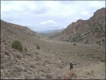
Peavine Canyon Trail Photo
This remote area has a lot to offer. A quiet campground, scenic trails and panoramic views can be found here.
Peavine Canyon Trail Photo
One of the campsites next to Peavine Creek.
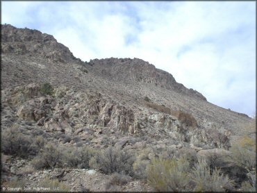
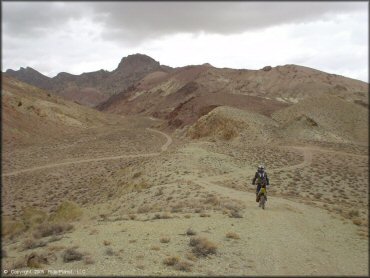
Peavine Canyon Trail Photo
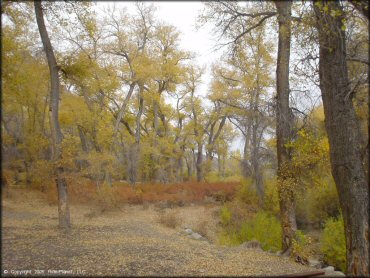
The scenery is rugged but beautiful. The further you get away from the campground the trees thin out and the vegetation turns into mostly sage and rabbitbrush.
Peavine Canyon Trail Photo
This is the entrance to Peavine Creek Campground. Each site comes with a picnic table, BBQ grill and fire ring. Most of the sites are pull through and can accommodate vehicles up to 25 feet. Camping is free but is limited to 14 days.
Peavine Canyon Trail Photo
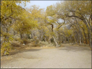
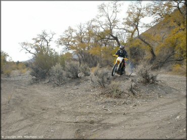
Most of the trails are actually old dirt roads. Nothing challenging but what it lacks in difficulty the area makes up in scenery and remoteness.
Peavine Canyon Trail Photo
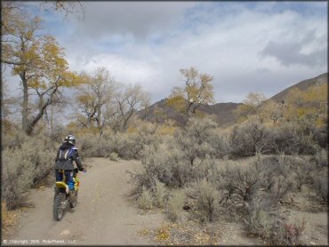
Another view of the trail.
Peavine Canyon Trail Photo
Peavine Canyon Trail Photo
Keep following the signs for Peavine Campground.
Peavine Canyon Trail Photo
Taking in the views.
Peavine Canyon Trail Photo
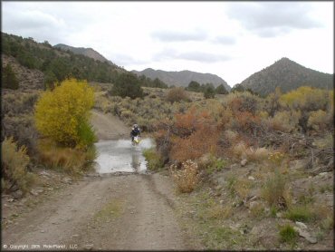
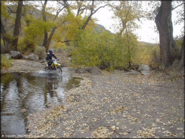
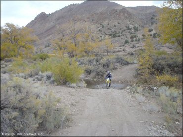
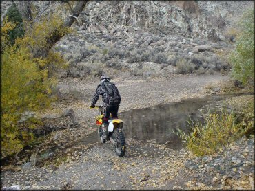
One of the shallow creek crossings.
Peavine Canyon Trail Photo
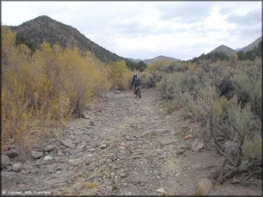
One of the rocky 4x4 trails.
Peavine Canyon Trail Photo
If you want to get away from it all, this is the place.
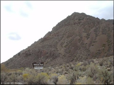
Peavine Canyon Trail Photo
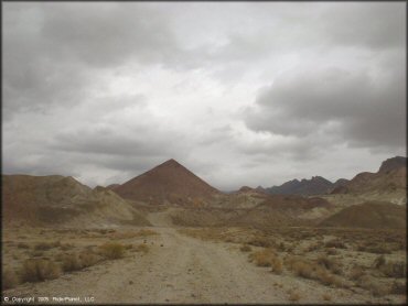
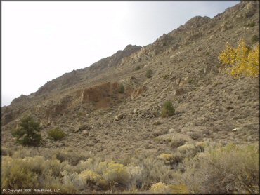
From a distance it looks like the Great Pyramid.
Peavine Canyon Trail Photo
Having a little fun!
Peavine Canyon Trail Photo
Peavine Canyon Trail Photo
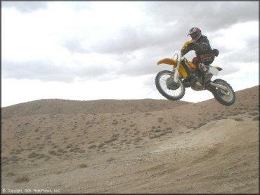
The play area along the right side of the access road has many small jumps.
RIDER COMMENTS & REVIEWS