 |
      |
| Home > Nevada |

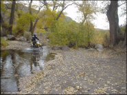 Peavine Canyon
Status: Open
Type: Trail (BLM, National Forest)
Location: Carvers, NV
Difficulty:

Peavine Canyon (not to be confused with Peavine Mountain north of Reno) is located northeast of Tonopah near the Arc Dome Wilderness in the Toiyabe Mountain Range. More...
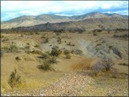
 Pilot Peak
 Status: Open
Type: Trail (BLM)
Location: West Wendover, NV
Difficulty:
Just a short drive from West Wendover, Nevada offers ATV riders around 50 miles of hard packed gravel roads that form several long loops. More...
Pine Forest Recreation Area Status: Open
Type: Trail (BLM)
Location: Denio, NV
Difficulty:

This part of northern Nevada offers rugged terrain, panoramic mountain views plus camping, hiking trails and excellent fishing. More...
 Prison Hill Recreation Area
 Status: Open
Type: Trail (City Land)
Location: Carson City, NV
Difficulty:
This trail system offers scenic views of the valley and it's unique rock formations provide a fun challenge for both jeeps and motorcycles. More...
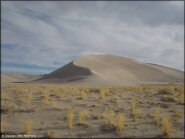
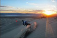 Sand Mountain
Status: Open
Type: Combo (BLM)
Location: Fallon, NV
Difficulty:
This is one of the most popular riding destinations in Nevada featuring one main dune (about 600 feet), and a number of smaller dunes. More...
 Sevenmile Canyon
 Status: Open
Type: Trail (BLM)
Location: Virginia City, NV
Difficulty:
This area features several miles of trails located in the scenic canyons surrounding Virginia City. More...
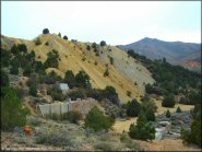
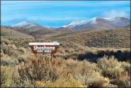 Shoshone OHV Trail System
 Status: Open
Type: Trail (BLM)
Location: Battle Mountain, NV
Difficulty:
After years of planning, the BLM officially opened this trail system to the public in 2010. More...
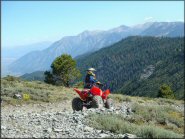 South Camp Peak Loop
 Status: Open
Type: Trail (National Forest)
Location: Glenbrook, NV
Difficulty:
Overlooking the eastern shores of Lake Tahoe, this area mainly consists of old fire roads and wide ATV trails. More...
 Tomera MX Track
 Status: Open
Type: Combo (Vacant Lot)
Location: Carlin, NV
Difficulty:
This small strip of undeveloped land holds a makeshift motocross track that is mostly hard packed, a play pit with some loose dirt mounds and a few rocks. More...
 Tonopah Dunes
 Status: Open
Type: Dune (BLM)
Location: Tonopah, NV
Difficulty:
This is the rough equivalent to Sand Mountain, but without the crowds, fees and regulations. More...