 |
      |
| Home > Arizona |

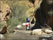 Florence Coke Ovens
Status: Open
Type: Trail (State Trust Land)
Location: Florence, AZ
Difficulty:

This area is very popular with the locals and if you go there you will know why. More...
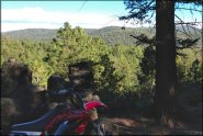 Fort Valley Trail System
Status: Open
Type: Trail (National Forest)
Location: Flagstaff, AZ
Difficulty:
This part of the Coconino National Forest offers about 20 miles of nicely maintained multiple use single track trails that form both short and long loops with gradual elevation changes and scenic mountain views. More...
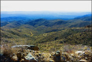
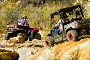
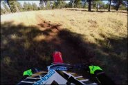
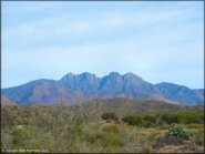 Four Peaks
Status: Open
Type: Trail (National Forest)
Location: Fort McDowell, AZ
Difficulty:
Deep sand washes, steep cliffs, desert single track, huge play areas, and ridge top Jeep and ATV trails with panoramic mountain views are among the many things this place has to offer. More...
 Happy Track Motocross Raceway
 Status: Open
Type: Track (Privately Owned / Commercial)
Location: Yuma, AZ
Difficulty:

This track is open for practice on select Saturday evenings. More...
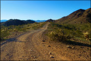
 Harquahala Mountain
 Status: Open
Type: Trail (BLM)
Location: Aguila, AZ
Difficulty:
This long 4x4 route starts at the base of Harquahala Mountain and climbs to the top and ends at the Historic Harquahala Observatory. More...
 Hayfield Draw OHV Area
 Status: Closed For Season (closed for summer, will reopen Fall 2026)
Type: Trail (National Forest)
Location: Cottonwood, AZ
Difficulty:
With a variety of play areas and a well maintained staging area featuring shaded tables, BBQ grills and restrooms, this is a great choice for a day of play with the kids. More...
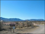
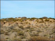 Hot Well Dunes
 Status: Open
Type: Combo (BLM)
Location: Bowie, AZ
Difficulty:
This unique recreation area features hot springs, onsite camping and limited amounts of shade. More...
 Hualapai ATV Trail
 Status: Open
Type: Trail (BLM, County Land, Mohave County)
Location: Kingman, AZ
Difficulty:
Hualapai Mountain Park has a designated ATV trailhead that provides access to 40 miles of motorized trails plus access to hundreds of miles of surrounding BLM trails. More...
 Kelly Canyon
 Status: Open
Type: Trail (National Forest)
Location: Flagstaff, AZ
Difficulty:
This trail system offers around 50 miles of single track trails that form nice long loops that wind through a mixed pine tree forest. More...
 La Posa OHV Routes
 Status: Open
Type: Trail (BLM)
Location: Quartzsite, AZ
Difficulty:
This popular winter destination offers hundreds of miles of marked desert roads and trails on BLM land that are open to motorized use. More...